Our Missions & Programmes
Copernicus, COSMO-SkyMed, MUSAR, European Ground Motion Service
NHAZCA (Natural HAZards Control and Assessment), Startup Company of "Sapienza" University of Rome, is a service and consultancy company, leader in the analysis and monitoring for the management and mitigation of risks of natural hazards and large infrastructures.
As a result of a constant effort in the innovation and optimization of the newest remote sensing technologies, NHAZCA provides to its customers cutting-edge solutions for the management, control and monitoring of natural and man-induced hazards, supporting the construction and administration of large infrastructures and natural resources exploitation projects, with a particular attention for a sustainable and responsible interaction between human activities and the natural environment.
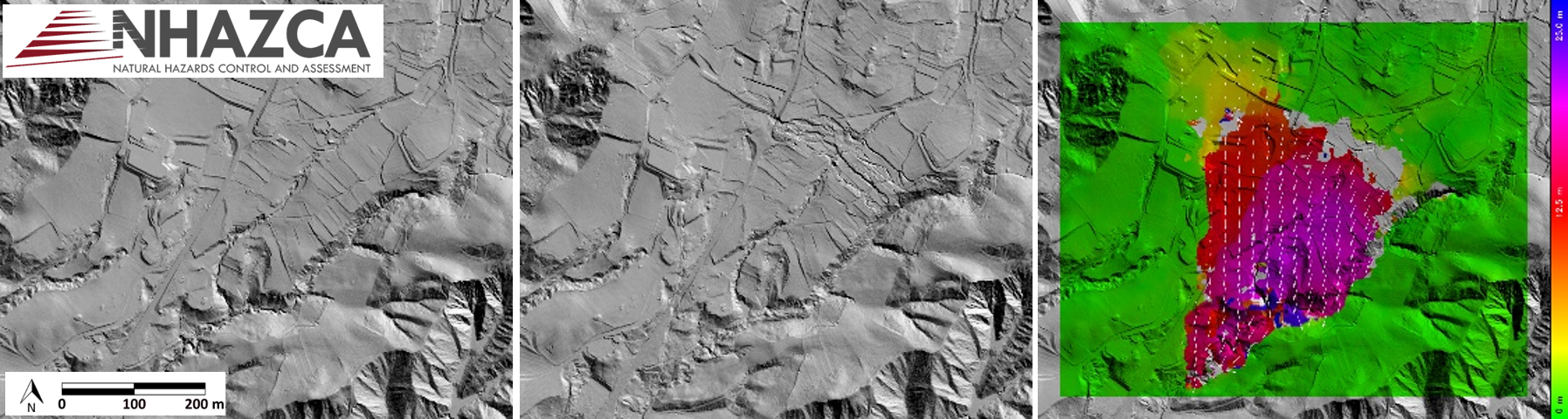
NHAZCA is an international leader in monitoring services through innovative technologies such as the Satellite (A-DInSAR) and Terrestrial (TInSAR) SAR Interferometry. Given the specific properties of radar sensors, such solutions allow the measurement and control of surface displacements of the ground and structures with millimeter accuracy.
NHAZCA develops also the PhotoMonitoring technology to monitor with extreme precision changes and surface movements of structures and terrain using images acquired from different platforms (terrestrial, aerial, satellite) and sensors (optical, multispectral, infrared, radar).
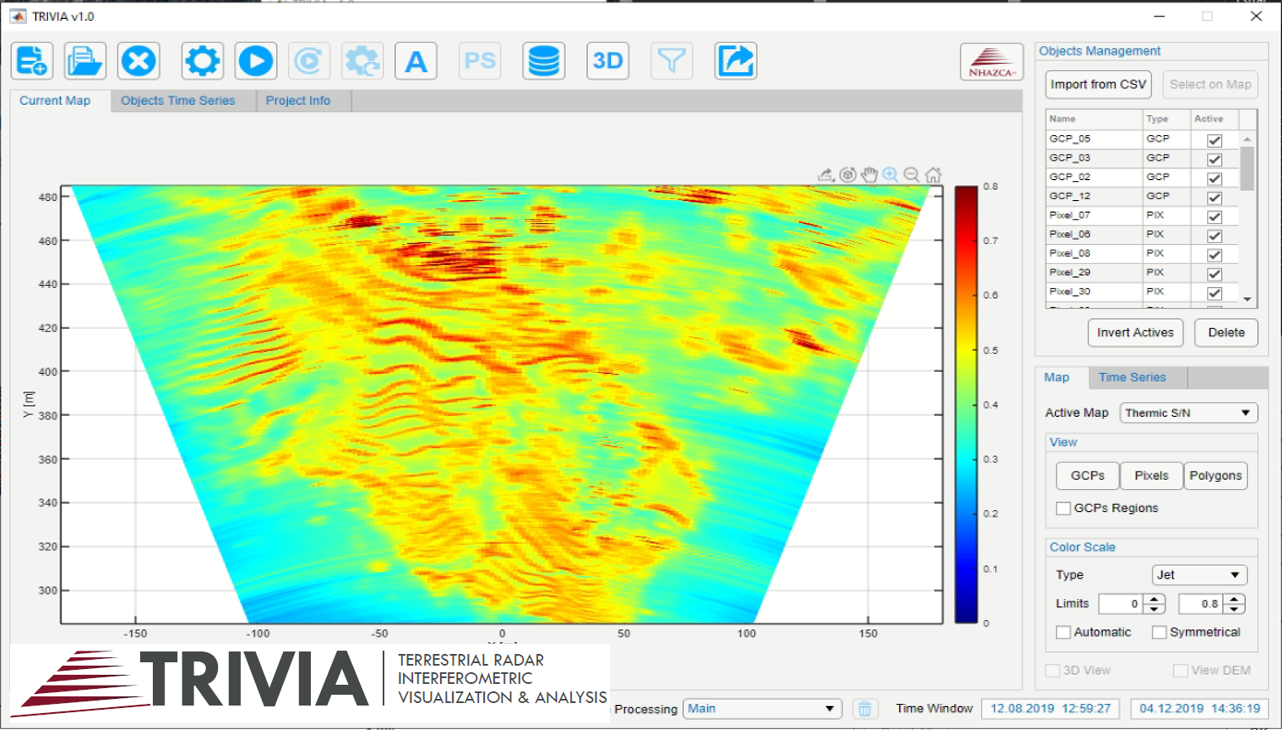
NHAZCA is constantly focused on Research and Development activities to internally design and develop the hardware and software tools to provide its tailored solutions to partners and clients.
NHAZCA supports key international asset managers in the following markets:
With an experience of more than 10 years of monitoring services and over 300.000 hours of continuous analyses, NHAZCA daily provides the finest personalized solutions for more than 300 customers from 40 different countries worldwide, representing a reliable partner able to provide high professional standards.
Via Vittorio Bachelet 12, 00185 Rome Rome, Italy
Via Vittorio Bachelet 12, 00185 Rome Rome, Italy
Paolo Mazzanti
+39 06 95065820
info@nhazca.com
info@nhazca.com
https://www.nhazca.it/
Downstream


NHAZCA provides monitoring, assessment and forecasting services related to geology, geomorphology, hydrogeology, and geotechnical and environmental engineering through the integration of the newest generation of remote sensing technologies. Moreover, the highly qualified technical and scientific staff is constantly focused on internal design, development and implementation of the necessary hardware and software tools to execute the projects.
NHAZCA makes use of the most advanced technologies, such as:
NHAZCA designs, develops, and realizes:
NHAZCA organizes professional training courses in collaboration with several professional orders and national and international associations. In the last 7 years, more than 600 participants, from over 40 different countries and 60 partner companies, attended the training courses organized by NHAZCA, providing very high satisfaction evaluations.
Our most relevant international events include:
Copernicus, COSMO-SkyMed, MUSAR, European Ground Motion Service